After a slightly bumpy, but fairly peaceful night, we pulled the anchor at about 7:20 AM. The Wrightsville Beach Bridge opens on the hour upon request and we were going for the 8:00 AM opening. We were only 1.5 miles away, but we also wanted to swing through a bay and wave at a friend who came to the end of his dock with coffee in hand to see us off.

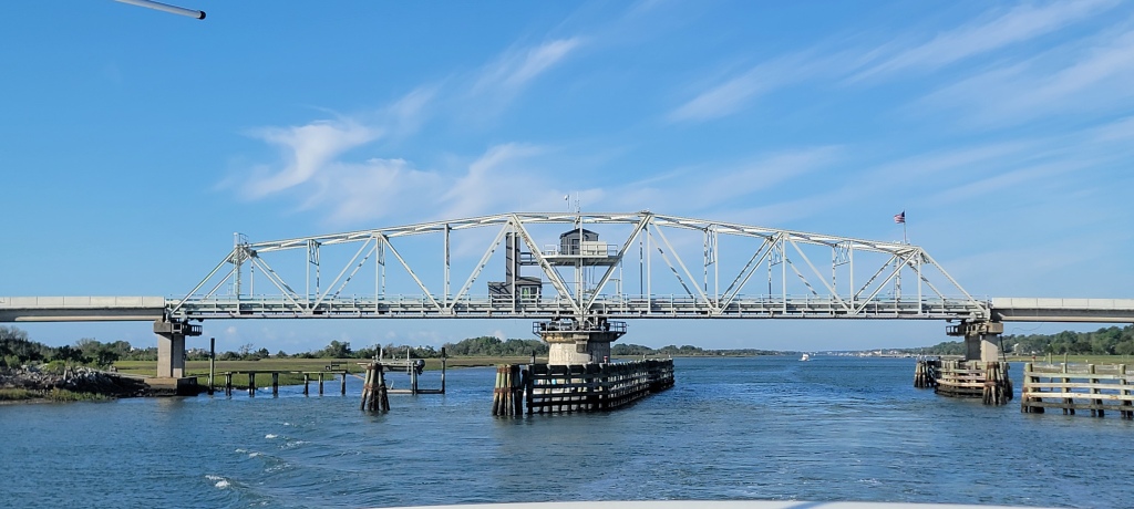
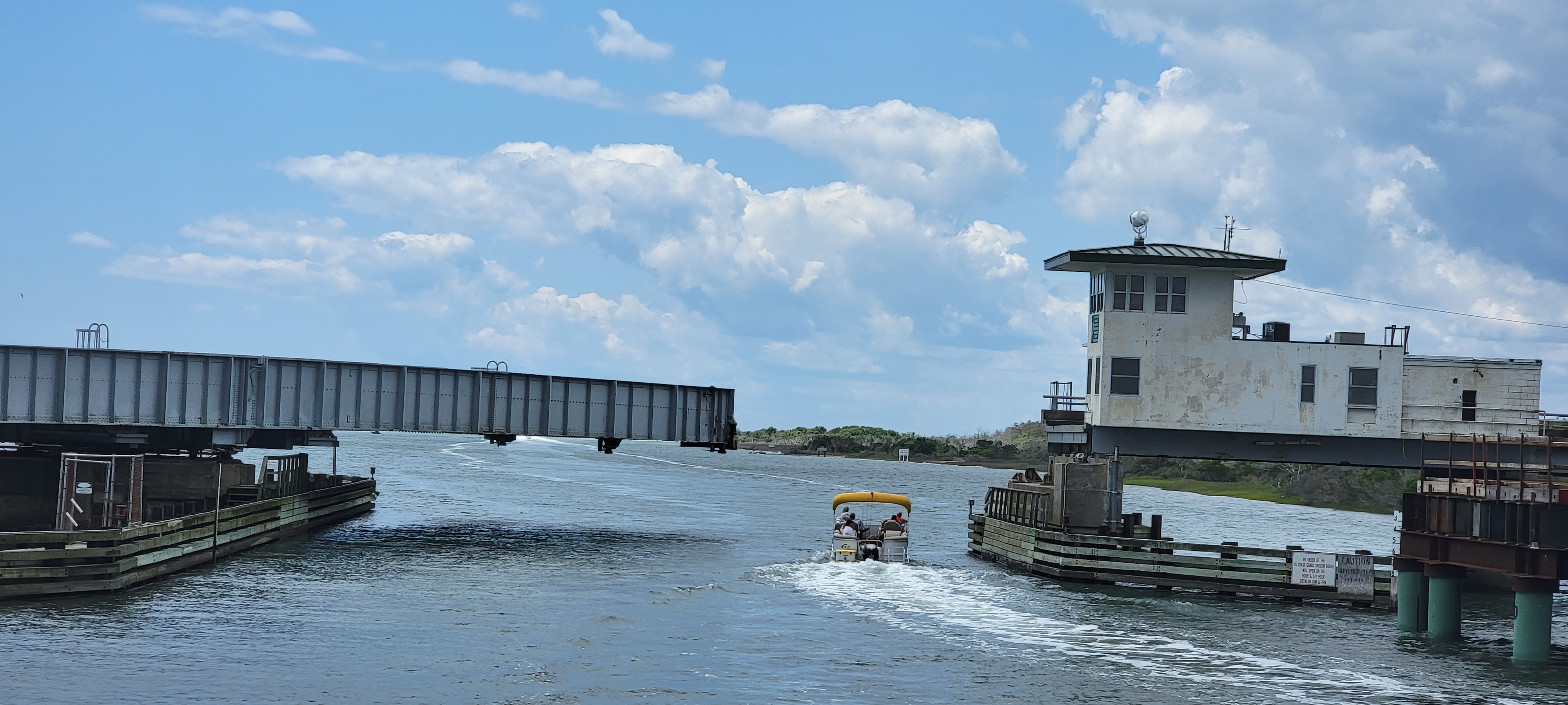
This particular bridge tender is reputed to be a bit brusque and a stickler for the rules. We had read stories about people who missed the opening because they didn’t radio correctly or waited too far away. We planned to do it right. When we radioed the tender on channel 13, the tender was perfectly polite and asked our air draft. We need 24′ with the antennas up and 20′ with them down. We were at low tide and he said we should have 22′-23′ feet at mid steel. We lowered the antennas and sailed right through! The tender gave us a little information about the next bridge and sent us on our way. He was helpful and friendly throughout!

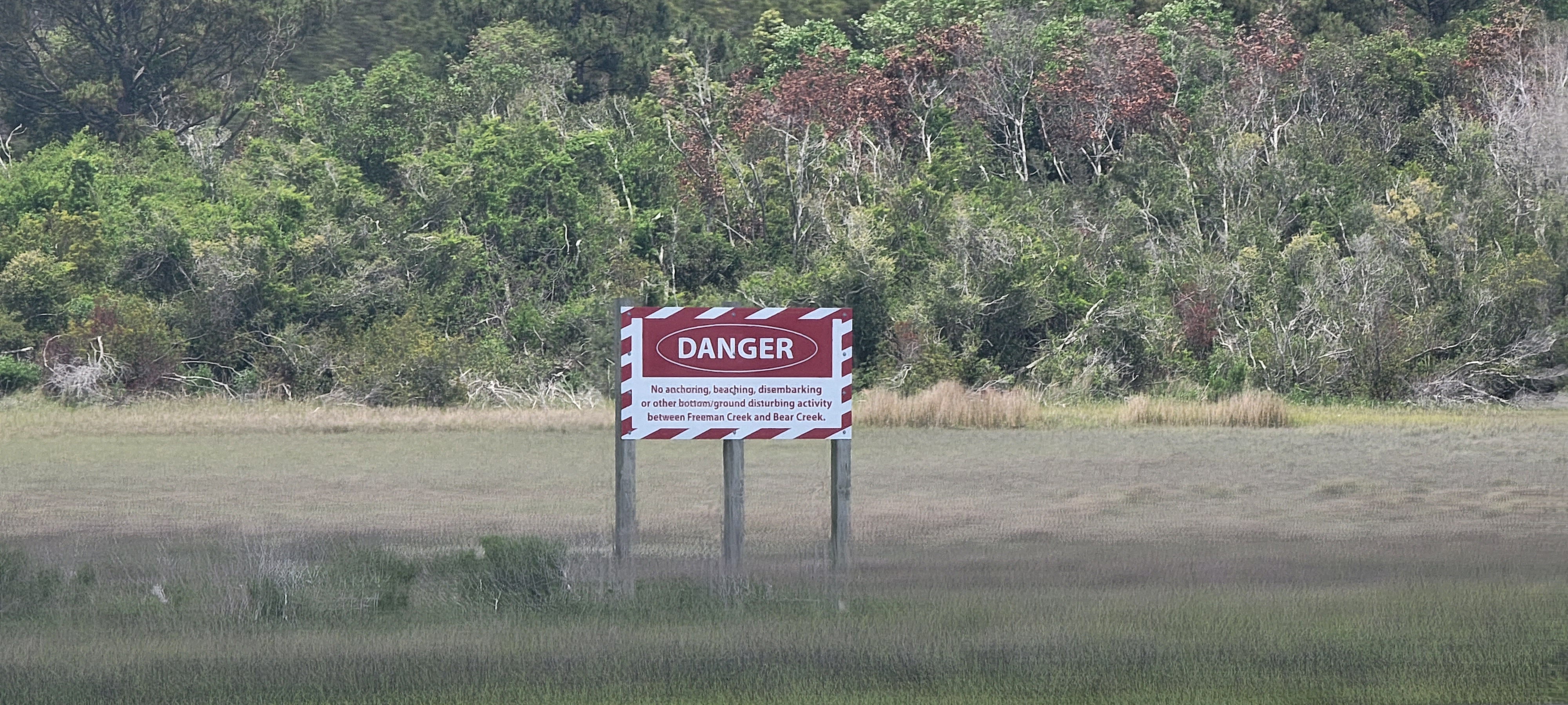
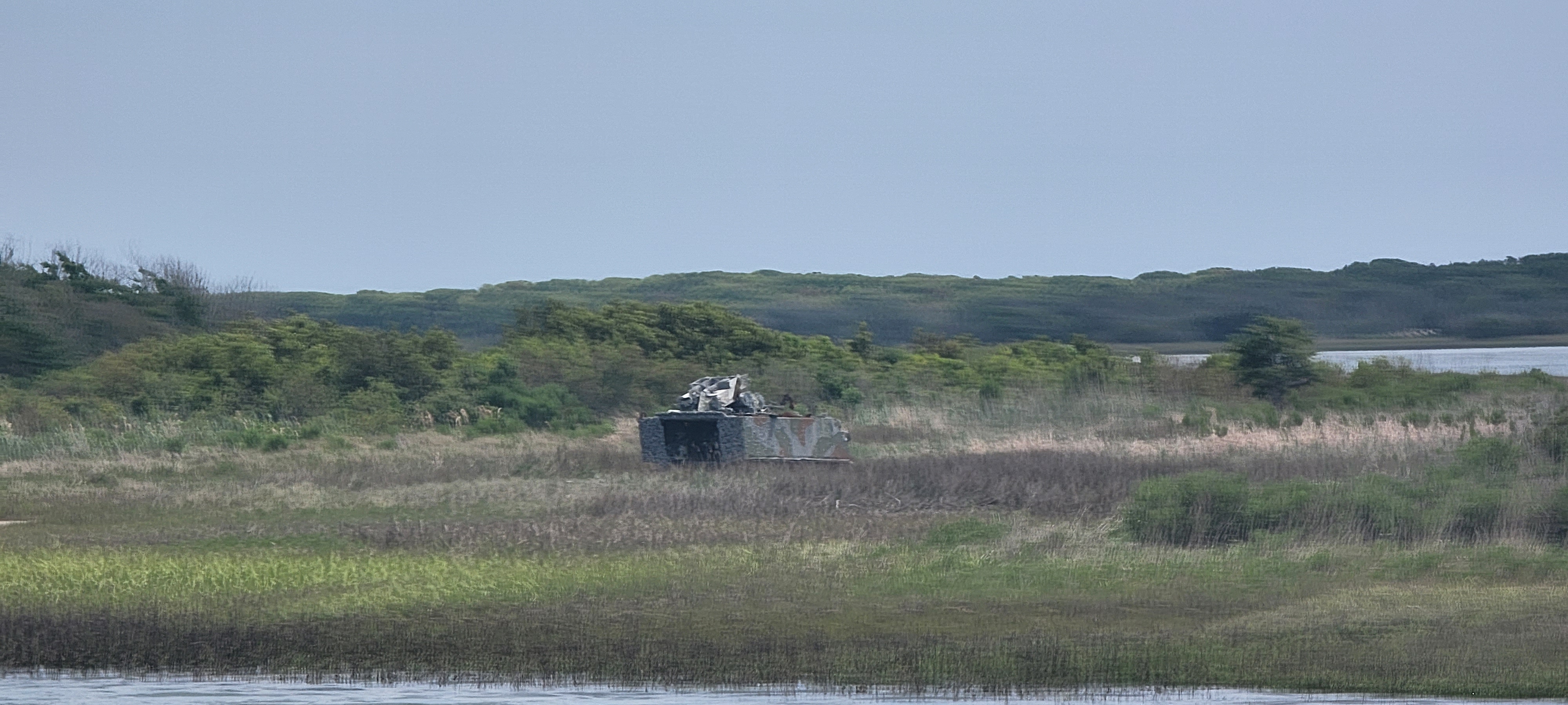
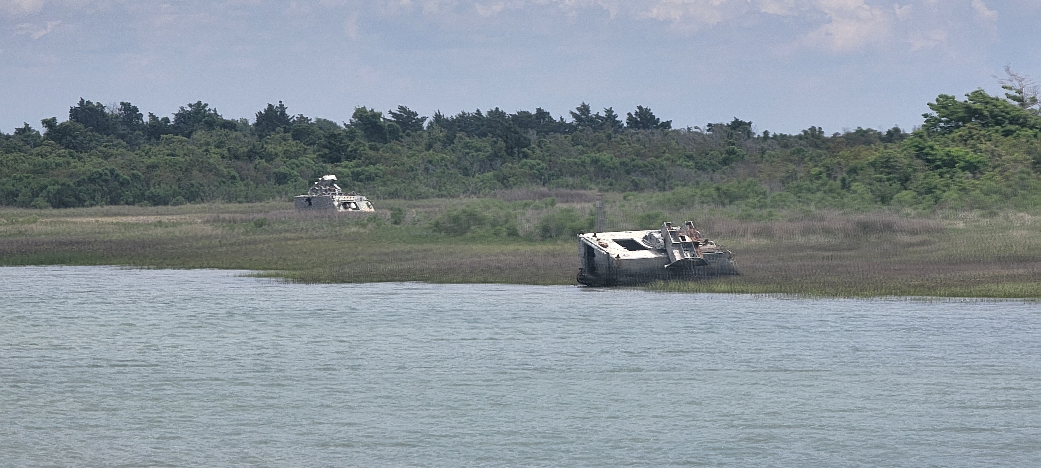
From there, we had about 90 miles to go to our next anchorage. We chugged along at about 10 mph for the next eight hours heading north on the ICW. One of the highlights was passing through Camp Lejeune. There is a big sign that warns if they are doing live fire exercises. Thankfully it was off and we sailed right through. The shore was littered with old vehicles from training exercises.


As usual, we had a plan and a backup plan. Plan A was to go outside at the Beaufort Inlet and go to an anchorage at Cape Lookout,. The anchorage is reputed to be stunning with pristine beaches, sea turtles, and dolphins throughout. Plan B was to anchor on the south side of Beaufort in Taylor Creek. It is a more crowded anchorage but offers a short dinghy ride to downtown Beaufort to enjoy the amenities of the town.
When we got to the Beaufort Inlet, it was very rough. We poked our bow into the inlet twice and decided it was too rough for us to attempt to go outside. On to Plan B… we went into Taylor Creek and there were 20+ boats anchored. We poked into a couple of potential spots, but ultimately thought that it was too tight to be comfortable.

Plan C. Looking through the guides and charts, it looked like the anchorage behind Shackleford Banks would be ideal. Some reviews said it was a bit shallow getting in, but the anchorage itself had deep water and was a favorite of locals. It offered a short dinghy ride to Shackleford Banks to see the wild horses and explore the beach.
We made our way back out to the inlet, we followed our Magenta line on Garmin and watched the charts. It looked like we would have a good path. We didn’t. As we went east of the inlet the waves were 3-4 feet coming on our starboard stern. We felt the boat lurch a bit as our props caught the bottom where the charts showed we should be in 18 feet of water. Ugh. Fortunately, it wasn’t very hard and the waves helped us navigate to some deeper water that we could see about 100 feet to the northwest. Once we got there, we had plenty of water to get into the anchorage, look around a bit for a good spot, and dropped the hook about 300 feet from the Red 2 buoy marking the end of a rockpile.

With 15kt-20kt winds, we decided to forgo the dinghy ride to shore. We were able to see some of the wild horses and I took a little swim to ensure that there wasn’t any serious damage to the hull (there wasn’t).


It proved to be a very rocky and restless night. The blow that we thought was going to come on Monday was now forecast to come in the next afternoon. We abandoned our plan to go to Belhaven and called around to find a slip in Beaufort for the week. It took some calling around, but Beaufort Yacht Club had an opening with one of their tenants gone for a few weeks.
We also called BoatUS to get some advice on getting safely out of the anchorage the next morning. Jay at BoatUS was super helpful and explained that the charts are way wrong. He explained the route out and said that the chart would show us going on dry land. Perhaps hearing the trepidation in my voice, he said to call in the morning and they would come escort us to safety.
Having our plan set for the morning, we got some shuteye as the strong winds shifted from SSW to N overnight.
(Added by Wendy: This afternoon, evening, and overnight were my very worst night on the Loop. It was scary running aground. I took two Bonine and was still queasy inside the boat overnight. This was only the third time I needed motion sickness medication since we left. The others were during our Gulf crossing and on the way back from the Bahamas. I did not throw up, but Owen made me a puke bucket out of a two liter Diet Dr. Pepper bottle.
It all ended just fine. If we had been hung up on the shallow part here, BoatUS was very close by if we needed help. We were bouncing up and down at anchorage, but we were not really in danger of coming loose or anything. So the “worst night” on the Loop was uncomfortable and I don’t want to do it again, but we didn’t feel unsafe or like the world was ending.)
